Utah Studies
Horse & Rider Grades 6-8
Grade Level(s)
6 - 8
Purpose
Students will explore the role that horses have played in culture and history by learning about draft horses in agriculture and mapping Pony Express stations across the state of Utah.
Estimated Time
1 hour per activity
Materials Needed
Interest Approach — Engagement
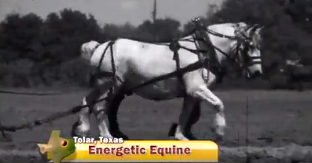
- Energetic Equine video
Activity 1: Utah Climate and Geography
- Utah Pony Express Map, 1 per student
- Computers for student use
- Google Earth
- Horse and Rider Google Earth Instructions
- Utah Pony Express Stations
- This file contains all of the Pony Express stations in Utah, as well as a brief description of each station and/or firsthand accounts of visitor experiences.
- Red pencil or pen for each student
Activity 2: Addressing a Letter
- Envelope, 1 per student
- Postage stamps, 1 per student
Essential Files (maps, charts, pictures, or documents)
Vocabulary Words
- draft horse: a large horse used for pulling heavy loads, especially a cart or plow
- horsepower: a unit used to measure the power of engines
- quarter horse: a small, strong horse that can run very fast for short distances
Did you know? (Ag Facts)
Horsepower is a measurement of work. It was created by James Watt who lived from 1736 until 1819. Watt wanted to measure the amount of energy required to raise coal out of a coal mine, so he created "horsepower" as the unit of measure. How much is one horsepower? One horsepower is equivalent to 33,000 foot-pounds of work performed in 1 minute, which can be achieved in many different combinations of feet and pounds.1
One horsepower equals all of the following:
- Lifting 33,000 pounds up 1 foot in 1 minute
- Lifting 1 pound up 33,000 feet in 1 minute
- Lifting 1,000 pounds up 33 feet in 1 minute
- Lifting 1,000 pounds up 330 feet in 10 minutes
- Lifting 100 pounds up 33 feet in 6 seconds
Background Agricultural Connections
Horses played an important role in the settlement and expansion of the American West. In Utah, the Mormon pioneers used a variety of draft animals, especially horses, mules, and oxen. The pioneer company that first settled in the Salt Lake Valley consisted of a group of 143 men, three women, and two children. They had 73 wagons, one cannon, 93 horses, 52 mules, 66 oxen, 19 cows, 17 dogs, and some chickens. The horses that made this trek were critical in helping to plow the dry desert soils to make it possible to grow the first crops in the state. These hardy animals were also the primary mode of transportation. Horses and mules were also used extensively on farms, in mines and forests, and later, in building railroads and roads that were eventually used by trains and automobiles. The term horsepower is a reminder of horses' ability to perform hard work day after day in a variety of conditions.

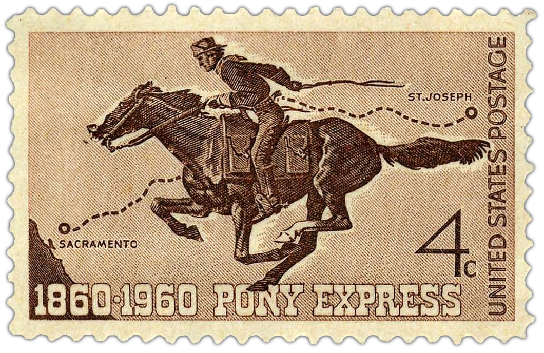
While draft horses did the heavy farm work, quarter horses were used for riding and to get places quickly. The Pony Express depended on fast horses and was an important piece of the history of the American West. Utah had several Pony Express stations. Although it only lasted a short time, the old trails can still be seen in the western deserts of Utah today. The Pony Express was a mail delivery service. It was very different from how we receive mail today. Beginning in 1860, young men on horseback carried letters from Missouri to California as fast as they could ride. Riding in the Pony Express across the western United States was very dangerous for the horses and the riders. Many of the men who rode in the Express were orphans who didn't have parents to worry about their safety. The Pony Express had 190 relay stations. There were 24 stations in Utah, starting in the very northeastern corner of the state near the Bear River Forest Service Station that now exists on the border of Utah and Wyoming. They continued westward across the state and through the west desert to Nevada. One of the most important desert stations was at Simpson Springs, roughly halfway between Lehi and the Nevada border. These springs were tapped and the water shipped to western locations—stations which otherwise would have been dry.
Many Utahns served as Express riders. The riders and station managers endured many hardships, including a Paiute uprising that disrupted service for a month. Express rider Elijah "Nick" Wilson of Grantsville, Utah was nearly killed by an arrow to the head near Spring Valley Station in Nevada.
The Pony Express generally provided excellent service, covering the 1,966-mile one-way distance in 10 days or less. It was the quickest form of mail delivery at that time, but it was very expensive—nearly $5 to send a letter. At its peak, the service employed 80 riders and 400 horses. In October 1861, the Pacific Telegraph was completed at Salt Lake City, and messages could be relayed almost instantaneously. The Pony Express became obsolete overnight.
Today, horses are still an important part of Utah's culture. Most horse owners live along the Wasatch Front in urban areas. Most of the horses are owned by people who live in Salt Lake, Utah, Weber, Davis, Cache, and Box Elder counties. Nearly two-thirds of these horse owners keep their horses for pleasure riding and enjoyment. Even though Utah horses are used mainly for fun activities, they still have an impact on Utah's economy. Horse owners buy feed and pay for veterinary care, farrier services (a farrier puts shoes on a horse's hooves), trucks and trailers, boarding, equipment, and tack. All of these things contribute to the agricultural sector of the state's economy.2
Interest Approach – Engagement

- Show students the America's Heartland video clip Energetic Equine.
- Discuss the video using the following questions:
- What are draft horses and mules used for? (These are work animals bred to pull heavy loads and work well with people. Prior to the invention of gas powered tractors, people relied on draft animals to pull tools that would till and plant fields and harvest crops. Draft animals also pulled carts and wagons, transporting goods from farm to market.)
- How do you think plowing a field with a team of horses compares to plowing a field with a tractor? (Horses were much slower and less efficient than tractors. As farm technology improved, farmers were able to produce more food with less labor. In 1850, it took 75-90 hours of work to produce 100 bushels of corn. In 1930, the same 100 bushels of corn could be produced with just 15-20 hours of work. The first gas powered tractor was built in 1890.) 3
- Explain to students that draft horses are not fast; different kinds of horses were bred to run fast and carry less weight. Before gas powered engines, people also relied on horses for transportation. The following lesson explores the importance of horses in Utah historically and today.
Procedures
Activity 1: Utah Climate and Geography
Teaching Note: Install the free Google Earth program to each computer. Then download the zipped file Utah Pony Express Stations, and extract it in advance to expedite the activity.
- Share the background information with students. Ask the students to describe the unique challenges of riding a horse as a Pony Express rider across the state of Utah (e.g., lack of water, extreme temperatures, Indian encounters, steep mountain ranges, lack of populated areas, wildlife challenges).
- Give each student a copy of the Utah Pony Express Map. Using a red pencil, have each student outline the county where they live. As a class, ask the students to identify the counties with Pony Express stations. Write these counties on the board.
- Ask the students to identify the cities that are now nearest the Express route (i.e., Henefer, Salt Lake City, Draper, Calleo, Ibapah). Write these cities on the board and then determine whether they are rural, suburban, or urban areas of Utah today.
- Emphasize the importance of the horse in Utah history. Have the students place a capital "H" in Salt Lake, Utah, Davis, Weber, Cache, and Box Elder counties. Horses are found in all counties of Utah, but these counties have the greatest number of horse owners.
- Explain to the students that they are going to use Google Earth to determine the topography of the Pony Express Stations and explore what it may have been like to pass through the station. Each student will need access to a computer (students can be paired if technology is limited), or if a projector is available, this can be done as a class activity.
- Assign each student or pair of students one or two Pony Express Stations from the list below.
- The Needles
- Echo Canyon
- Halfway
- Weber Station
- East Canyon
- Bauchmann's Station
- Mountain Dell
- Salt Lake House
- Traveller's Rest
- Camp Floyd
- East Rush Valley
- Rush Valley Station
- Point Lookout
- Government Creek
- Simpson Springs
- River Bed
- Dugway
- Blackrock
- Fish Springs
- Boyd Station
- Willow Springs
- Round Station
- Canyon Station
- Deep Creek
- While using the computers, have the students access the file Utah Pony Express Stations with Google Earth. Students will find that each of the stations is marked across the state with a pushpin symbol.
- Have the students click on their assigned pin and read the information.
- Using their mouse to zoom in on their location, ask students to look at the topography of the area and identify any landmarks, streams, roads, forests, mountains, or other indicating features of the landscape. To help them with their exploration within Google Earth, students should complete the questions at the bottom of the Utah Pony Express Map.
- Remind students that Utah’s climate varies greatly from place to place around the state. Climates can be affected by latitude, elevation, and distance from the ocean. In general, Utah climates can be grouped as desert, steppe, and mountain. Deserts are defined by very low levels of precipitation. Mountain climates get relatively high levels of precipitation and have very cold winters and cool summers. The steppe climate is in between desert and mountain and favors the growth of grasses and shrubs. Many of the Pony Express Stations in Utah are located within the Great Basin. It may help the students to remind them of the characteristics of this landform region while they view the satellite images of their area.
- Draw a large outline of Utah on the board. Have the students tape their observations and analysis of their Pony Express Stations to the proper location on the map on the board. Facilitate a discussion on the similarities and differences of various station locations throughout the state.
Activity 2: Addressing a Letter

- Ask the students if they have ever received a letter in the mail. Show the students a piece of mail that has been postmarked. Ask them to identify the elements of the postmark (i.e., the stamp, address, city, state, ZIP code, postmark date, and location). Have the students identify how long it took for the mail to be sent from one location to the next. Tell them that generally mail can be received within a couple of days, or even overnight if a person is willing to pay an additional fee.
- Have the students identify other forms of communication that are widely used today (e.g., email, telephone, text messaging, social media). Discuss how we communicate today and the advantages and disadvantages of each method. Discuss the role of penmanship, spelling, and composition in conveying an effective message.
- Instruct students on how to address an envelope and send a letter. Students should then write a letter to a friend or relative that describes, in their own words, the adventures and experiences of a Pony Express rider. Have the students mail their letters from the school to their homes. Students may want to predict how many days it will take for their letters to be delivered.
Concept Elaboration and Evaluation
After conducting these activities, review and summarize the following key concepts:
- Horses play an important role in Utah’s culture and history.
- Historically, horses were indispensable to agricultural production and for transportation. Today, they are more commonly used for recreation.
- The Pony Express was a mail delivery service that crossed Utah in 1860 and 1861. At this time, the fastest way to travel or send a message across the country was by horse.
- Agricultural production and transportation have become much faster and more efficient due to advances in technology.
Enriching Activities
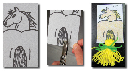
Make a Horsetail Bookmark
Materials: 3" x 5" cards, pencils, crayons, a paper punch, and yarn

- Sketch a horse and tail from the rear on the card with a pencil. Make sure the tail is wide enough to have a yarn tail later.
- Use a paper punch to cut three holes in the tail. Make sure they aren’t too close to the edge of the paper or the yarn may rip out.
- Cut some lengths of yarn (about six for each hole) and run them through the holes. Now tie another piece of yarn around the tail you made; this will keep it all together. Cut off the ends of the tail to make it even.
- Color the horse.
Have your students watch the one-minute Wonders of the West video Pony Express Story.
Suggested Companion Resources
- Immigration, Migration, and the Industrial Revolution (Book)
- Google Earth on the Range Repeat Photographs (Kit)
- Atlas of the Historical Geography of the United States (Poster, Map, Infographic)
- Changes & Challenges: Utah Agriculture (Multimedia)
- Frontier House (Multimedia)
- Growing a Nation Multimedia Timeline (Multimedia)
- Glidden's Patent Application for Barbed Wire (Website)
- Tractor Timeline- A History of Tractors (Website)
Sources/Credits
- http://auto.howstuffworks.com/horsepower.htm
- https://extension.usu.edu/cache/files/uploads/HORSES%20ARE%20IMPORTANT%20TO%20LOCAL%20ECONOMY.pdf
- https://growinganation.org/
Author(s)
Debra Spielmaker
Organization Affiliation
Utah Agriculture in the Classroom
- Describe the significance of pioneers in Utah history. Meeting the following indicator:
- Explore the pattern of Mormon settlement throughout the West. Recognize how the Mormon pioneers’ heritage influences Utah today.
- Investigate the significant events during America's expansion and the roles people played. Meeting the following indicator:
- Compare the trails that were important during westward expansion (e.g. Oregon, Mormon, Spanish, California).


